

Our company is involved in preparing official permits from the Polish Ministry of Development and Technology, which allows us to export all dual-use drones, optics, and portable radiophones without VAT on the Polish side / and without VAT on the Ukrainian side.
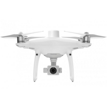
Phantom 4 RTK + D-RTK 2 + Ent Shield Basic Combo
5765.21 £ net price (non-EU countries)
 100% secure payments

Viktoriia Turzhanska
Product Manager![]() /
/ ![]()
+48723706700![]() +48723706700
+48723706700![]() +48723706700
+48723706700
[email protected]
Anatolii Livashevskyi
Product Manager![]() /
/ ![]()
+48721808900![]() +48721808900
+48721808900![]() +48721808900
+48721808900
[email protected]
Michał Skrok
Product Manager
![]() /
/ ![]()
+48721807900![]() +48721807900
+48721807900
[email protected]
Description
Next Generation Mapping
DJI has rethought its drone technology from the ground-up, revolutionizing its systems to achieve a new standard for drone accuracy – offering Phantom 4 RTK customers centimeter-accurate data while requiring fewer ground control points.
Centimeter-Level Positioning System
A new RTK module is integrated directly into the Phantom 4 RTK, providing real-time, centimeter-level positioning data for improved absolute accuracy on image metadata. In addition to optimized flight safety and precise data collection, the Phantom 4 RTK stores satellite observation data to be used for Post Processed Kinematics (PPK), which can be conducted using DJI Cloud PPK Service. Fit the Phantom 4 RTK to any workflow, with the ability to connect this positioning system to the D-RTK 2 High Precision GNSS Mobile Station, or NTRIP (Network Transport of RTCM via Internet Protocol) using a 4G dongle or WiFi hotspot.
Gather Accurate Data with TimeSync
To take full advantage of the Phantom 4 RTK’s positioning modules, the new TimeSync system was created to continually align the flight controller, camera and RTK module. Additionally, TimeSync ensures each photo uses the most accurate metadata and fixes the positioning data to optical center of the lens – optimizing the results from photogrammetric methods and letting the image achieve centimeter-level positioning data.
Precise Imaging System
Capture the best image data with a 1-inch, 20-megapixel CMOS sensor. Mechanical shutter makes mapping missions or regular data capture seamless as the Phantom 4 RTK can move while taking pictures without the risk of rolling shutter blur. Due to the high resolution, the Phantom 4 RTK can achieve a ground sample distance (GSD) of 2.74 cm at 100 meters flight altitude.To ensure each Phantom 4 RTK offers unparalleled accuracy, every single camera lens goes through a rigorous calibration process, with parameters saved into each image’s metadata, letting post-processing software adjust uniquely for every user.
Built for Surveyors
Offering a range of control schemes and complimentary technologies, the DJI Phantom 4 RTK is developed to provide survey-grade results with greater efficiency than ever before.
Purpose-Built Application
A new DJI GS RTK app and Remote Controller with built-in screen, giving users a streamlined control scheme for surveying missions and other data acquisition scenarios.The GS RTK app allows pilots to intelligently control their Phantom 4 RTK, with multiple planning modes, including Photogrammetry (2D and 3D), Waypoint Flight, Terrain Awareness, Block Segmentation, and more. Users can also import KML/KMZ files to optimize the workflow for their missions.With the built-in screen, pilots can clearly view and plan their missions on an ultra-bright, 5.5-inch HD display.
Access a Variety of 3rd Party Applications
Pilots with experience using 3rd party apps on DJI drones can access the world's leading drone app ecosystem for their Phantom 4 RTK with the SDK Remote Controller. Users can plug in a compatible Android or iOS device and install any compatible DJI Mobile SDK-enabled app to harness the full power of their Phantom 4 RTK.
OcuSync Transmission System
Enjoy stable and reliable HD image and video transmission at distances of up to 7 km, great for mapping larger sites.
Seamless Compatibility with D-RTK 2 Mobile Station
Support your Phantom 4 RTK missions with the D-RTK 2 Mobile Station – providing real-time differential data to the drone and forming an accurate surveying solution, or acquire accurate location coordinates when used as an RTK rover. The Mobile Station’s rugged design and OcuSync transmission system ensures you can gain centimeter-level accurate data with your Phantom 4 RTK in any condition.
Start Mapping Today
With a built-in flight planning app (GS RTK) and an easy method to collect RTK data (RTK Network or D-RTK 2 Mobile Station), pilots have a full solution for any surveying, mapping or inspection workflow – right out of the box.
Specs
Aircraft
Takeoff Weight 1391 g
Diagonal Distance 350 mm
Max Service Ceiling Above Sea Level 19685 ft (6000 m)
Max Ascent Speed 6 m/s (automatic flight); 5 m/s (manual control)
Max Descent Speed 3 m/s
Max Speed 31 mph (50 kph)(P-mode), 36 mph (58 kph)(A-mode)
Max Flight Time Approx. 30 minutes
Operating Temperature Range 32° to 104° F (0° to 40℃)
Operating Frequency 2.400 GHz to 2.483 GHz (Europe, Japan, Korea), 5.725 GHz to 5.850 GHz (United States, China)
Transmission Power (EIRP) 2.4 GHz CE (Europe) / MIC (Japan) / KCC (Korea) :< 20 dBm ; 5.8 GHz SRRC(China) / FCC(United States)/NCC(Taiwan,China):< 26 dBm
Hover Accuracy Range RTK enabled and functioning properly:Vertical:±0.1 m;Horizontal:±0.1 m ; RTK disabled Vertical:±0.1 m(with vision positioning ); ±0.5 m(with GNSS positioning) Horizontal:±0.3 m(with vision positioning); ±1.5 m(with GNSS positioning)
Image Position Offset The position of the camera center is relative to the phase center of the onboard D-RTK antenna under the aircraft body's axis:(36, 0, and 192 mm) already applied to the image coordinates in Exif data. The positive x, y, and z axes of the aircraft body point to the forward, rightward, and downward of the aircraft, respectively.
Mapping Functions
Mapping Accuracy Mapping accuracy meets the requirements of the ASPRS Accuracy Standards for Digital Orthophotos Class Ⅲ
Ground Sample Distance(GSD) (H/36.5) cm/pixel, H means the aircraft altitude relative to shooting scene (unit: m)
Data Acquisition Efficiency Max operating area of approx. 1 km² for a single flight(at an altitude of 182 m, i.e., GSD is approx. 5 cm/pixel, meeting the requirements of the ASPRS Accuracy Standards for Digital Orthophotos Class Ⅲ
Vision System
Velocity Range ≤31 mph(50 kph) at 6.6 ft(2 m) above ground with adequate lighting
Altitude Range 0-33 ft(0 - 10 m)
Operating Range 0-33 ft(0 - 10 m)
Obstacle Sensing Range 2-98 ft(0.7-30 m)
FOV Forward/Rear: 60° (horizontal), ±27° (vertical), Downward: 70° (front and rear), 50° (left and right)
Measuring Frequency Forward/Rear:10 Hz; Downward: 20 Hz
Operating Environment Surfaces with clear patterns and adequate lighting(> 15 lux)
Camera
Sensor 1" CMOS; Effective pixels: 20 M
Lens FOV 84°;8.8 mm / 24 mm(35 mm format equivalent:24 mm); f/2.8 - f/11, auto focus at 1 m - ∞
ISO Range Video:100-3200(Auto) 100-6400(Manual);Photo:100-3200(Auto) 100-12800(Manual)
Mechanical Shutter Speed 8 - 1/2000 s
Electronic Shutter Speed 8 - 1/8000 s
Max Image Size 4864×3648(4:3);5472×3648(3:2)
Video Recording Modes H.264,4K:3840×2160 30p
Photo Format JPEG
Video Format MOV
Supported File Systems FAT32(≤ 32 GB);exFAT(> 32 GB)
Supported SD Cards MicroSD, Max Capacity: 128 GB. Class 10 or UHS-1 rating required Write speed≥15 MB/s
Operating Temperature Range 32° to 104° F (0° to 40℃)
Intelligent Flight Battery(PH4-5870mAh-15.2V)
Capacity 5870 mAh
Voltage 15.2 V
Battery Type LiPo 4S
Energy 89.2 Wh
Net Weight 468 g
Charging Temperature Range 14° to 104℉(-10° to 40℃)
Max charging Power 160 W
Intelligent Battery Charing Hub(WCH2)
Input Voltage 17.3 - 26.2 V
Output Voltage and Current 8.7 V,6 A;5 V,2 A
Operating Temperature 41° to 104℉(5° to 40℃)
SDK Remote Controller
Operating Frequency 2.400 GHz to 2.483 GHz (Europe, Japan, Korea), 5.725 GHz to 5.850 GHz (Other countries/regions)
EIRP 2.4 GHz CE / MIC / KCC: < 20 dBm ; 5.8 GHz FCC / SRRC / NCC: < 26 dBm
Max Transmission Distance FCC / NCC: 4.3 mi (7 km); CE / MIC / KCC / SRRC: 3.1 mi (5 km) (Unobstructed, free of interference)
Built-in Battery 6000 mAh LiPo 2S
Operating Current / Voltage 1.2 A @ 7.4 V
Mobile Device Holder Tablets and smartphones
Operating Temperature 32° to 104° F (0° to 40° C)
GNSS
Single-Frequency, High-Sensitivity GNSS Module GPS+BeiDou+Galileo(Asia);GPS+GLONASS+Galileo(other regions)
Multi-Frequency Multi-System High-Precision RTK GNSS Frequency Used:GPS:L1/L2;GLONASS:L1/L2;BeiDou:B1/B2;Galileo:E1/E5a ; First-Fixed Time:< 50 s ; Positioning Accuracy: Vertical 1.5 cm + 1 ppm(RMS);Horizontal 1 cm + 1 ppm(RMS)1 ppm means the error has a 1mm increase for every 1 km of movement from the aircraft.
Gimbal
Stabilization 3-axis (tilt, roll, yaw)
Pitch -90° to +30°
Max Controllable Angular Speed 90°/s
Angular Vibration Range ±0.02°
Infrared
Obstacle Sensing Range 0.6-23 ft(0.2 - 7 m)
FOV 70°(Horizontal)
±10°(Vertical)
Measuring Frequency 10 Hz
Operating Environment Surface with diffuse reflection material, and reflectivity> 8%(such as wall,trees, humans, etc.)
Remote Controller
Operating Frequency 2.400 GHz-2.483 GHz(Europe,Japan,Korea), 5.725 GHz-5.850 GHz(United States, China)
Transmission Power (EIRP) 2.4 GHz CE / MIC / KCC:< 20 dBm ; 5.8 GHz SRRC / FCC:< 26 dBm
Max Transmission Distance FCC:4.3 mi(7 km);SRRC / CE / MIC / KCC:3.1 mi(5 km) (Unobstrcted, free of interference)
Power Consumption 16 W(typical value)
Display 5.5 inch screen, 1920×1080, 1000 cd/m², Android System, Memory 4G RAM+16G ROM
Operating Temperature Range 32° to 104° F (0° to 40℃)
Intelligent Flight Battery Charging Hub(PHANTOM 4 CHARING HUB)
Voltage 17.5 V
Operating Temperature Range 41° to 104℉(5° to 40℃)
Capacity 4920 mAh
Voltage 7.6 V
Battery Type LiPo 2S
Energy 37.39 Wh
Operating Temperature -4° to 104℉(-20° to 40℃)
AC Power Adapter(PH4C160)
Voltage 17.4 V
Rated Power 160 W
D-RTK 2 Mobile Station
D-RTK 2 Mobile Station is DJI’s upgraded high-precision GNSS receiver that supports all major global satellite navigation systems, providing real-time differential corrections that generate centimeter-level positioning data for improved relative accuracy.
Centimeter-Level Positioning
D-RTK 2 Mobile Station fully supports GPS, GLONASS, Beidou, and GALILEO signals. Easy and quick to set up, the D-RTK 2 Mobile Station provides real-time differential data for drones to achieve centimeter-level positioning accuracy. The built-in high-gain antenna offers better signal reception from more satellites even when obstructions are present.
Stay Connected for Any Mission
D-RTK 2 Mobile Station supports communication via 4G, OcuSync, WiFi, and LAN, ensuring uninterrupted, stable data transmission under any application scenario. Up to 5 remote controllers* can be connected to the D-RTK 2 Mobile Station simultaneously when used with DJI Agras drones, the Phantom 4 RTK, or the P4 Multispectral. When used with the Matrice 300 RTK, it can be connected to multiple aircraft, making coordinated operations involving multiple drones a possibility and significantly improving efficiency.
Durability You Can Trust
Featuring IP65 level ingress protection and a lightweight carbon fiber body, the D-RTK 2 Mobile Station is ultra-portable and up for any task, no matter how tough. The built-in IMUs monitor movements and calibrate the tilt sensors to alert the operator of any abnormalities during the mission, minimizing risks.
A Comprehensive Solution
The D-RTK 2 Mobile Station is compatible with Phantom 4 RTK, P4 Multispectral, MG-1P RTK, Agras T16, Agras T20, Matrice 210 RTK V2 and Matrice 300 RTK*. It also supports DPS (DJI Positioning Service), which provides high precision positioning data within the cover range of the base station, making it the ideal tool for surveying, aerial inspections, agriculture, and other industrial applications.
Data sheet

Official permits of the Ministry of Development and Technology
Our company is involved in preparing official permits from the Polish Ministry of Development and Technology, which allows us to export all dual-use drones, optics, and portable radiophones without VAT on the Polish side / and without VAT on the Ukrainian side.