
Our company is involved in preparing official permits from the Polish Ministry of Development and Technology, which allows us to export all dual-use drones, optics, and portable radiophones without VAT on the Polish side / and without VAT on the Ukrainian side.
DJI Zenmuse L1 (EU) SP
6099 $ net price (non-EU countries)
Viktoriia Turzhanska
Product Manager![]() /
/ ![]()
+48723706700![]() +48723706700
+48723706700![]() +48723706700
+48723706700
viktoria@ts2.space
Anatolii Livashevskyi
Product Manager![]() /
/ ![]()
+48721808900![]() +48721808900
+48721808900![]() +48721808900
+48721808900
anatolii@ts2.space
Michał Skrok
Product Manager
![]() /
/ ![]()
+48721807900![]() +48721807900
+48721807900
michal@ts2.pl
Description
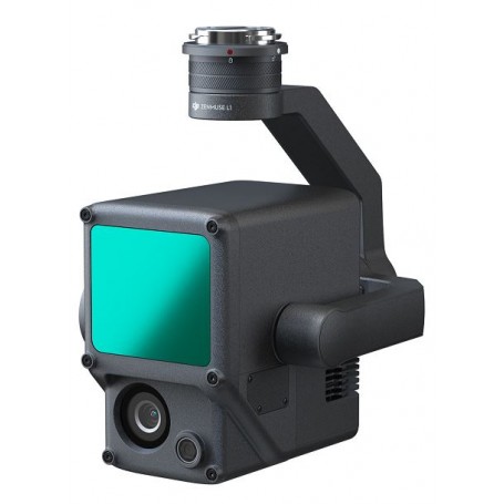
DJI Zenmuse L1: Precision Lidar & RGB Solution for Aerial Surveying
Special Offer: Enjoy 6 months of DJI Terra for free!
The DJI Zenmuse L1 is an advanced aerial surveying solution that combines a Livox Lidar module, a high-accuracy IMU, and a state-of-the-art camera featuring a 1-inch CMOS sensor. Mounted on a 3-axis stabilized gimbal, it integrates seamlessly with the Matrice 300 RTK and DJI Terra to provide comprehensive, real-time 3D data capture. With the L1, you can efficiently document complex structures and generate precise reconstructions at any time of the day.
- Integrated Technologies: Combines Lidar, RGB camera, and high-accuracy IMU
- Coverage: Survey up to 2 km² in a single flight
- Accuracy: Vertical Accuracy: 5 cm; Horizontal Accuracy: 10 cm
- Point Rate: 240,000 points per second
- Detection Range: 450 m (at 80% reflectivity)
- Durability: IP54 ingress protection for use in various weather conditions
- Live Data: Real-time point cloud visualization
Key Features
Digitize with Precision
Leverage the L1’s capabilities to create true-color point cloud models instantly or amass up to 2 km² of data in a single sortie with its wide 70° FOV Lidar module and high-resolution camera.
Unmatched Accuracy
Achieve centimeter-level reconstructions utilizing the L1’s high-precision IMU, vision sensor, and GNSS data integration.
Ready for Any Condition
With an IP54 rating, the L1 is built to operate in rain or fog, and its active scanning method allows for nighttime flights.
Real-time Insights with Livox Lidar Module
- Frame Lidar with up to 100% effective point cloud results
- Effective Point Rate: 240,000 pts/s
- Multi-return capability with 3 returns
- Non-repetitive scanning pattern for thorough data collection
Comprehensive RGB Camera
- 20 MP resolution with a 1-inch CMOS sensor
- Mechanical shutter for precise images
High-Accuracy IMU
- Integrated vision sensor for enhanced positioning
- Fusion of GNSS, IMU, and RGB data for superior detail accuracy
Application Scenarios
- Topographic Mapping: Quickly create accurate digital elevation models.
- AEC and Surveying: Manage projects with high-precision point clouds and 3D models.
- Emergency Response: Gather real-time insights around the clock with true-color point clouds.
- Law Enforcement: Obtain situational awareness and forensic data in real-time.
- Energy and Infrastructure: Model and manage complex structures with precision.
- Agriculture and Forestry: Analyze vegetation and growth trends effectively.
Specifications
General
- Dimensions: 152×110×169 mm
- Weight: 930±10 g
- Power Consumption: Typical: 30 W; Max: 60 W
- IP Rating: IP54
- Supported Aircraft: Matrice 300 RTK
- Operating Temperature: -20° to 50° C (-4° to 122° F)
System Performance
- Detection Range: 450 m at 80% reflectivity
- Point Rate: Up to 240,000 pts/s
- Accuracy: Horizontal: 10 cm; Vertical: 5 cm
- Real-time Point Cloud Modes: Reflectivity, Height, Distance, RGB
Lidar and Camera Details
- Ranging Accuracy: 3 cm at 100 m
- Maximum Returns Supported: 3
- RGB Mapping Camera: 20 MP, 1-inch sensor
- Photo Format: JPEG; Video Format: MOV, MP4
Data Storage and Processing
- Supports microSD Cards up to 256 GB
- Compatible with DJI Terra for post-processing
- Export Formats: PNTS, LAS, PLY, PCD, S3MB
Explore the full capabilities of the DJI Zenmuse L1 and transform how you capture and analyze aerial survey data.
Data sheet

Official permits of the Ministry of Development and Technology
Our company is involved in preparing official permits from the Polish Ministry of Development and Technology, which allows us to export all dual-use drones, optics, and portable radiophones without VAT on the Polish side / and without VAT on the Ukrainian side.