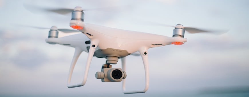
Pix4Dreact - 1 Year Floating License (1 Device)
zoom_out_map
chevron_left chevron_right

Our company is involved in preparing official permits from the Polish Ministry of Development and Technology, which allows us to export all dual-use drones, optics, and portable radiophones without VAT on the Polish side / and without VAT on the Ukrainian side.

Pix4Dreact - 1 Year Floating License (1 Device)

Introducing Pix4Dreact, a 1-year floating license for 1 device, designed specifically for emergency response and public safety. This cutting-edge software enables rapid 2D mapping, providing crucial support in time-sensitive situations. Its fast processing speed and user-friendly interface ensure professionals can gather critical information swiftly and efficiently. With a floating license, organizations can maximize usage, allowing multiple users to access the software on different devices, one at a time. Invest in Pix4Dreact for your team and enhance your ability to make informed decisions during emergencies and contribute to public safety.
£341.41


341.41 £ net price (non-EU countries)

100% secure payments

Viktoriia Turzhanska
Product Manager
Українська / Polski
+48723706700
+48723706700
Telegram +48723706700
[email protected]

Anatolii Livashevskyi
Product Manager
Українська / Polski
+48721808900
+48721808900
Telegram +48721808900
[email protected]

Michał Skrok
Product Manager
English / Polski
+48721807900
Telegram +48721807900
[email protected]

Description

Capture

Fly your drone to capture the images you need. Plan an optimized and automated flight with an app like PIX4Dcapture for Parrot and DJI drones.

Process

Combine large numbers of images in minutes with PIX4Dreact. Create measurable 2D maps in the field or back at base.

*Results and speed will vary according to image size and number.

Examine

With PIX4Dreact’s simple tools, identify and measure points of interest, mark and evaluate your maps while on the ground to provide powerful data needed to take action.

Share

Export your maps to ensure teams and decision makers are provided with effective information when it’s needed most.

Respond

With up-to-date maps, gain precious time, improve safety and reduce costs when responding to an evolving situation.

The mapping software for emergency response

Get rapid and reliable situational awareness for quick decisions and collaboration in the field.

Fast

PIX4Dreact creates 2D maps from aerial imagery in minutes. Because when every second counts, up-to-date and reliable information is of utmost importance to teams on the ground.

Easy to use

Simple and intuitive to use, even in complex and stressful situations. PIX4Dreact is developed with public safety and humanitarian aid professionals to meet their unique challenges.

Lightweight and robust

Lightweight enough to work on a mid-range computer in the field. PIX4Dreact doesn’t rely on an internet connection or the cloud for processing.

Reliable situational awareness in complex situations

  • FAST AND INTUITIVE MAPPING
  • MEASURE AND MARK AREAS OF INTEREST
  • COMPARE MAPS
  • FAST AND EASY EXPORT
  • SHARE TO PIX4DCLOUD
  • FIT FOR PURPOSE

The map you need when you need it

Ensure teams and decision makers are provided with timely and effective information needed to take action

2D orthomosaic map

PIX4Dreact uses fast-stitching technology to create accurate 2D orthomosaic maps by combining a large number of nadir drone images.

Export format: geoTIFF

Markers and measurements

Mark areas of interest or GPS coordinates within the project and assess the situation on the ground for smoother collaboration or long-term documentation. 

Markers export formats: GeoJSON, KML, Shapefile

Measurements export format: PDF

Screenshots and whole maps

Document and collaborate in seconds with options to export your maps as screenshots or a whole map that can be imported into PIX4Dreact on another computer.

Screenshots export format: JPEG

Whole maps export format: p4r

PDF Report

Easily share a 2D orthomosaic, location data and markers in one file over email. Customize the report by white labeling it with your company details and logo. 

Export format: PDF


Pix4D floating licenses

Pix4D licenses are floating licenses that allow one to:

  • Be logged in to a Pix4D application on one or more devices (laptop or desktop machine) at the same time. The number of devices depends on the license.
  • Install Pix4D desktop software on as many computers as wanted without the need to uninstall Pix4D desktop software to move the license to another computer.

If you are already using the software on the maximum number of seats allowed by your license (for instance two), it is not possible to log into the Pix4D desktop application on a third computer at the same time.

To free a seat, simply log out of the software on the computer you currently use your license on and log into the Pix4D app on the new computer of your choice.

If you do not have access to the computer currently using one of your multiple seats, you can remotely deactivate a device.

Data sheet

RL1WW6FTVI

Official permits of the Ministry of Development and Technology

Our company is involved in preparing official permits from the Polish Ministry of Development and Technology, which allows us to export all dual-use drones, optics, and portable radiophones without VAT on the Polish side / and without VAT on the Ukrainian side.