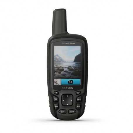

Garmin GPSMAP 64csx (010-02258-20) Handheld GPS with Navigation Sensors and Camera
Description
Garmin GPSMAP 64csx Handheld GPS Navigator with Advanced Sensors and Camera
Part Number: 010-02258-20
Equipped with a high-resolution 8 MP Camera, Altimeter, and Compass for precision navigation.
Key Features:
- Durable Design: Rugged and water-resistant with easy button operation and a 2.6” sunlight-readable color display.
- Comprehensive Mapping: Preloaded TopoActive maps with routable roads and trails ideal for cycling and hiking.
- Advanced Navigation: High-sensitivity receiver with quad helix antenna and multi-GNSS support (GPS, GLONASS, and Galileo).
- Wireless Connectivity: Seamlessly connect via BLUETOOTH® and ANT+® technologies.
- Integrated Camera: 8-megapixel autofocus camera for geotagging photos and documenting your journey.
- Long-Lasting Power: Up to 16 hours of battery life in GPS mode.
Explore the Terrain
The GPSMAP 64csx is preloaded with TopoActive maps, providing detailed information on natural features, waterways, buildings, and international boundaries. Discover thousands of points of interest like parks, restaurants, and accommodations to enhance your adventure.
Stay on Track
With a quad helix antenna and multi-GNSS support, this device ensures fast and accurate positioning, even in challenging environments. The 3-axis compass and barometric altimeter further enhance navigation precision.
Share Your Adventure
Wirelessly share waypoints, tracks, and routes with other compatible Garmin devices. Stay connected with smart notifications for emails, texts, and alerts from your paired device. The GPSMAP 64csx also supports accessory sensors like the tempe™ temperature sensor and heart rate monitor.
Document and Relive Your Journey
Capture the essence of your adventures with the built-in 8-megapixel camera. Each photo is geotagged, allowing you to easily revisit locations or share them with friends.
Geocaching Made Easy
Enjoy paperless geocaching by uploading GPX files directly to your device and viewing key information such as location and terrain.
Specifications:
- Dimensions: 2.4" x 6.3" x 1.4" (6.1 x 16.0 x 3.6 cm)
- Display: 2.6" diagonal (160 x 240 pixels) color TFT
- Weight: 8.1 oz (230 g) with batteries
- Waterproof: IPX7
- Memory: 8 GB internal (expandable via 32 GB max microSD™ card)
- Battery: 2 AA batteries (NiMH or Lithium recommended)
Additional Features:
- Automatic routing for outdoor activities
- Access to hunt/fish calendars, sun and moon information
- Compatible with custom maps (up to 500 map tiles)
- LED beacon flashlight for enhanced visibility
Perfect for hiking, cycling, geocaching, and climbing, the Garmin GPSMAP 64csx is your reliable companion for all your outdoor adventures.